December 26th
Time to leave Collingwood, we had a frantic hour phoning family and friends in the UK first though, still strange to think our Christmas is now over and theirs were still in full swing. Anyway we packed up and headed back toward Cape Farewell. Today we were going to walk to the most Northerly Lighthouse on the South Island.
There has been mention of our fascination with lighthouse's. It's not that we are anoraks, far from it but just think about it, lighthouses are usually at the end of peninsular with magnificent views looking over the sea and surrounding area. A bonus is always when one is allowed to climb to the top, the views are even more impressive. So now you know why we go, It's for the walks, the views and of course Ian wanted to do the four corner lighthouses of both islands. There will be more as our tour continues on this island, and rest assured, lots more waterfalls! Now, we are anoraks where they are concerned!
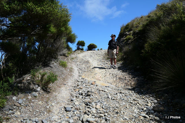
It was to the Pillar Point track car park where the uphill walk started from. Good walking shoes a must because the terrain was quite stony and difficult. Poles to the ready, and we set off to do the 1.5 km walk.
 |
| All the way up there! |
The light at the top of the point can hardly be described as a lighthouse, so different it is from the conventional ones. It is the most Northerly although not an information board anywhere stating that fact. But as I said previously the views during the climb were amazing.
Took the usual photo of Ian with the light just to prove we had got there.
The track continued upwards, and we very nearly decided just to turn around and go back down. OMG...so very glad we continued up because at the very end of the track was this.
 |
| Farewell Spit. The tour bus on Christmas Eve drove the length of this. |
 |
| Whanganui Inlet |
The descent was difficult for me. Anyone with 'knees' will know what I mean. I'll climb any hill without a problem (apart from the heart racing and trying not to pass out with not enough oxygen) but the going down....and this is where the poles come into their own, they helped immensely. 40 minutes to climb to the top and an hour to get down!
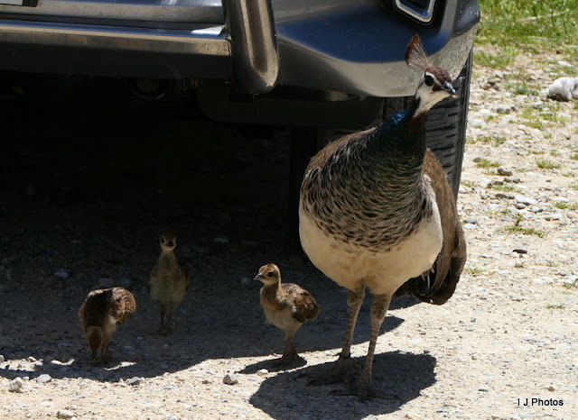
Back to base it was nearly lunch time. Ian suggested we go to Wharariki beach a few km further on. Here we could make a sandwich and have a coffee. What we hadn't realised was to get onto the beach a further 20-minute hike through farmland was necessary, and after that first walk my knee was still suffering. We I decided it was not for me and Ian always the gentleman said he would forgo that opportunity too. I have since found out (web) that the beach is the most Northerly point on the South Island...shh...best not mention that eh! Most surprising in the car park was a Peahen with chicks.
So we back tracked along the gravel road, a car pulled off the verge in front of us, and the dust thrown up from his wheels was bad but nothing compared to when we met other cars coming toward us. Chokingly bad, windows hurriedly closed and ventilation system set to recirculate the air from inside rather than outside.
Back into Collingwood for a quick shop. I had noticed a sign pointing to a historic cemetery, intrigued we went to investigate.
It was here we found out that Collingwood could very easily have become the capital of New Zealand.
There was a path leading to another viewing point. 10-minute walk, well I was game even with that dodgy knee. I stupidly only wore my jandles (thongs) gosh I don't think that path has been walked in ages. I gave up half way, sent Ian on ahead to get the photo, he came back with a video....men! Thankfully he has a video editor and could take a still from the footage.
We have returned to the NZMCA site at Port Tarakoh. It is a convenient stopping place for the Wainui waterfall. We plan to walk to that tomorrow.
And seen on route
And another great post box this time outside a small airfield.
On the coast road to Port Tarakoh
And wildlife


2 comments:
Some fabulous photos and the adventure continues! I am fairly sure we haven't been to Port Tarakohe - looking on Google Maps, it looks like a good place to visit!
Mxx
I&I,
Having Collingwood as the capital city was clearly an idea hatched in London, UK, with no knowledge of the terrain! A combination of arrogance and imagination rather than trusting on-site surveyors to find the best places ... And let's not forget the ignoring of the existence of Māori who already had sovereignty over the land.
But imagine if Collingwood had become the capital - what a trip to get to Parliament by boat or over the Takaka Hill! There was also a plan to have Russell in the Far North be the capital - similar issues re access for representation.
The Wakefields had similar idiotic town plans drawn up for New Plymouth without knowing the terrain - there's almost no flat land but lots of hills and valleys and streams down to the sea. Accordingly, the town square is right next to the beach instead of anywhere near the centre and there are no roads radiating out from it.
Our colonial history is littered with such silliness. However the settlers (If I can let myself ignore their avaricious ways and sense of entitlement about taking up land, i.e. wresting it from Māori) had hard lives and faced many huge challenges. The toffs, not so much - they still had servants, they were still rich and getting richer...
Big hugs, Mxx
Post a Comment